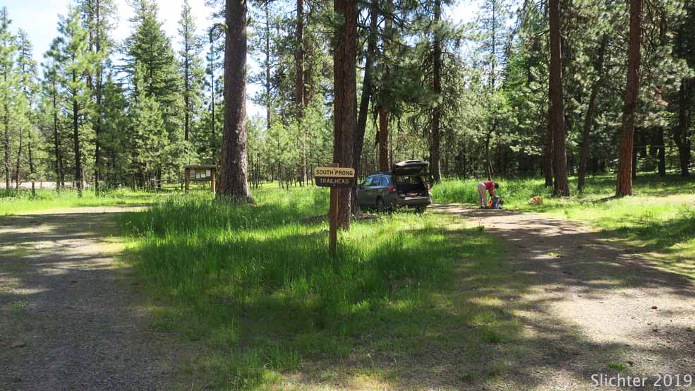
Mud Springs Horse Camp has 6 campsites with picnic tables and fire rings with two vault toilets. There is no water sources here, and it's probably not the best spot for filtering water. I'd say that the sites nearest the entrance and the trailhead for the South Prong Trail #821 are best suited for tent camping. Those downhill to the south are good for trailer use or pickup-camper use. The campground is lightly used except during holiday weekends and during hunting season. Since it's a horse camp, I'd probably recommend that if you plan to camp here, check with the Ochoco NF Ranger Station in Prineville, OR to see if they know whether Back Country Horsemen or other equestrian or volunteer groups are staging out of this site. Give the ranger station a call if you are coming from out of town.
South Prong Trail #821 provides access into the southwest and central portion of the Black Canyon Wilderness from the Mud Springs Horse Camp. The trail is a little over 5 miles long with an elevation loss of about 1655' with the high point of 5170' at Crow Bar Point and the low point of 3515' at the Big Ford of Black Canyon Creek. The trailhead begins at 5000' at Mud Springs CG. Most of the elevation loss is in the last 2 miles north of Crowbar Springs.
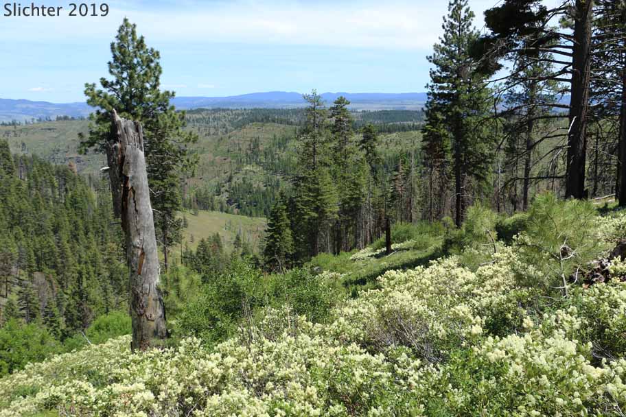
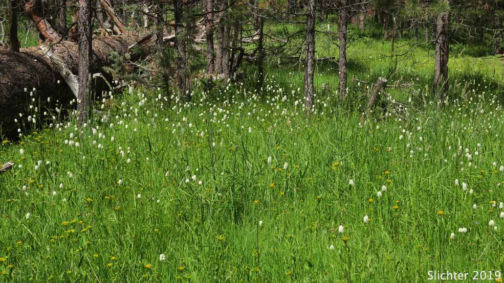
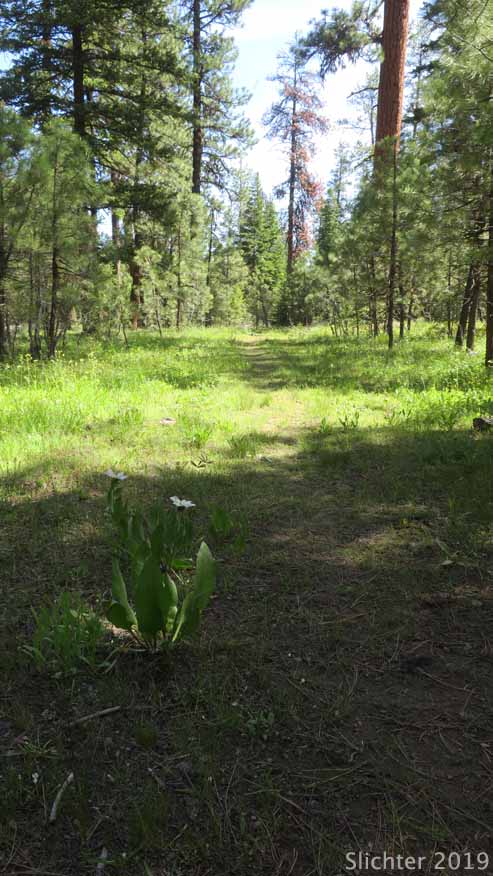
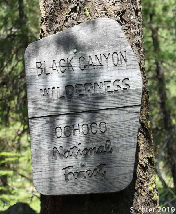
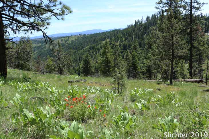
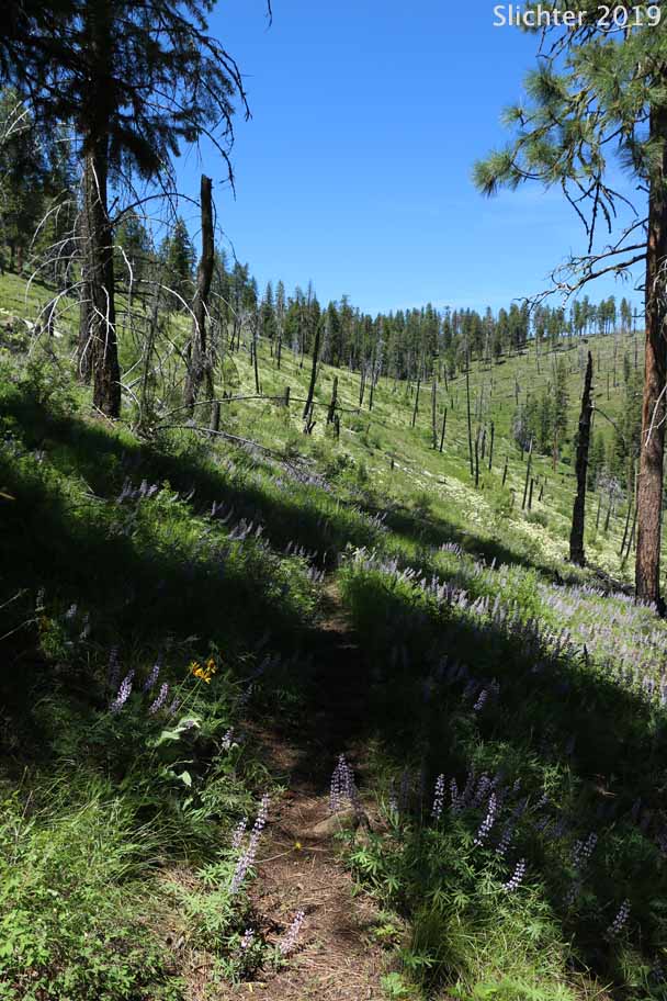
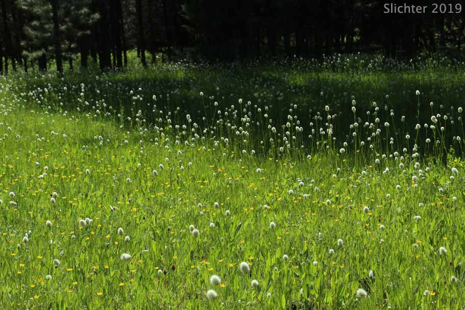
From the Mud Springs trailhead one passes through an old gate and follows an old road just east of floriferous wetlands from late May into late June downhill to the crossing of South Prong Creek. Except after rain events or during snow melt, the crossing should be fairly easy. The trail then heads east above the north bank of South Prong Creek for about one-third mile where you enter the signed Black Canyon Wilderness and the trail climbs more steeply north for a short ways. The trail then slowly ascends south-facing slopes of a mix of open conifer forest and dense snowbrush (Ceanothus velutinus) to open scabland slopes. At the east side of Crow Bar Point, the trail turns north briefly before beginning its steep descent downhill to Black Canyon Creek at Big Ford. This is a nearly 1650' descent.
The portion of the trail between the South Prong Creek crossing and Big Ford Crossing at Black Canyon Creek passes through patches of burned forest. Snags are beginning to fall over the trail. For a number of years the trail saw little use and was not cleared as a result. We noted in 2019 that a trail crew (or a volunteer group of equestrians) cleared fallen snags and punched openings through dense patches of snowbrush and did some trail tread work and water bar cleaning, at least out as far as Crowbar Springs. The tread is sometimes hard to follow. Part of the trail has stones laid along the outer edge and one can look for the 1-2' wide flatter path on the slope, but we found it fairly easy to find when we needed to look for it in places where the tread was faint. For a day drip, we found the route out to Crowbar Springs to be a good lunch spot and turn around location (6.2 miles round trip). There are numerous wildflowers from late May to late June that bloom along the trail, making for slow going if you are stopping to look at or photograph plants! We also noted a good variety of butterflies which could be more observed at any location where a small creek crossed the trail!
The area has been lightly used, partly due to several recent wildfires that burned through creating hazard snags which continously fall after wind events or due to high snow load. Access was thus restricted to most users although some hardy backpackers and autumn hunters still used the area. We noticed that at least some of the trails into the wilderness had recently been cleared in the spring of 2019. Not knowing whether this effort was performed by a USFS crew or the Backcountry Horsemen, but we send our thanks! If visiting the area, I'd probably contact one of the recreation staff at the USFS office in Prineville to inquire about current trail conditions into the wilderness.
Carry plenty of water or a water filter during a hike into the wilderness. Trails with southern exposure can be quite hot on mid-summer days due to the lack of trees. I've heard rumours of rattlesnakes at some point in the canyon.... something to especially consider if you hike with dogs.
Note: The twelve mile long Black Canyon Trail #820 has at least a dozen water crossings of Black Canyon Creek which can be difficult due to rushing water from mid-winter into early summer.
Note: We've run into a few people who have had vehicles broken into at trailheads on this forest during weekends (especially holidays), so it's probably wise to not leave a vehicle with any kind of gear visible inside at a trailhead during a long day out in the field, or overnight if backpacking, although I'd say that Mud Springs Horse Camp is very lightly visited except on holiday weekends!
Allow for almost a two hour drive to access the South Prong Trailhead when arriving from Prineville.
It's probably faster to access this trailhead via Oregon Highway 380 and several county roads from Paulina, OR.
From Paulina:
A faster alternative to arrive at Mud Springs Horse Camp is to: Drive east on Paulina-Suplee Highway (County Road 112) for 3.5 miles. Veer left onto Beaver Creek Road (County Road 113). After about 1.5 miles, stay right onto County Rd 135 which heads east through scenic ranch and farm lands south of the forest. The road eventually turns northeast, then due north where at about 9 miles you turn onto FS Rd 58 and drive east through BLM lands. As you enter woodlands note the nice displays of mule's ears (Wyethia amplexicaulis) beneath the trees around Memorial Day into early June. After passing into the forest you'll come to FS Rd 5840 about 4 miles east of County R 135. Drive north-northwest uphill along FS Road 5840 (good quality) for about 7 miles to the entrance to Mud Springs Horse Camp (spur road 800) which houses the trailhead for South Prong Trail #821.
For a slower, forest alternative: Drive east on Paulina-Suplee Highway (County Road 112) for 3.5 miles. Veer left onto Beaver Creek Road (County Road 113) and continue north for 8 miles to the Ochoco National Forest Boundary. At the boundary, County Road 113 becomes Forest Road 58. Drive north on FS Rd 58 for 1.5 miles to Sugar Creek Campground. Note that the Sugar Creek Campground Group Recreation site is about 100 yards east of the junction of Rds 58 and 5810, and that is a good site for a picnic or a bathroom break. Sugar Creek Campground has water during the main camping season and is a quiet campground. Use of the Ochoco National Forest map is helpful for finding your way on this particular route.
From Sugar Creek CG drive east on FS Rd 58 an additional 2.5 miles or so to FS Rd 5820. Note that older maps indicate Rager Ranger Station another mile and a half to the east, but this was fully decommissioned and removed in 2019.
Turn north onto FS Rd 5820 and drive the good gravel road north through open pine forest with nice scablands ablaze with early spring flowers about 4-4.5 miles to a junction with FS Rd 5830 where you turn right. In good weather, one can drive a quarter mile east and turn left uphill along the 200 spur road which is rough but suitable for a high clearance AWD/4WD vehicle except when really wet or early in season. It arrives just opposite (slightly downhill) from the entrance to Mud Springs CG.
We chose to drive FS Rd 5830 which has a good surface east to FS Rd 5840 where we turned uphill 2.5-3 miles on this excellent road to the entrance to Mud Springs Trailhead which houses the trailhead for the South Prong Trail #821.
Higher elevation slopes here hold snow late into the spring, so you might inquire at the Ochoco National Forest Ranger Station in Prineville about road conditions if you visit in mid to late May.
June 16, 2019: Mud Springs Campground and South Prong Trail # (Ochoco National Forest & Black Canyon Wilderness)
Mill Creek Wilderness, Bridge Creek Wilderness, Black Canyon Wilderness Map, Ochoco National Forest 1998 printing - This is quite handy for navigating lightly used trails in these thre wildernesses! You might still be able to obtain this at the Prineville Ranger Station. You might call ahead to see if they have it in stock!
Black Canyon Wilderness - General Ochoco National Forest website info about the wilderness with a pdf trail map and links to info regarding trails and trailheads.
South Prong Trail #821 - General Ochoco NF info about the trail.
Mud Springs Horse Camp - General Ochoco NF info about this site.
100 Hikes/Travel Guide Eastern Oregon" by William L. Sullivan - Trail description for access into the wilderness from Boeing Field. Brief route descriptions into the wilderness from the South Prong and Wolf Mountain railheads are also described at the back of the book in the "More Hikes" section in my 2001 edition.
 -
- 
 -
-  -
- 
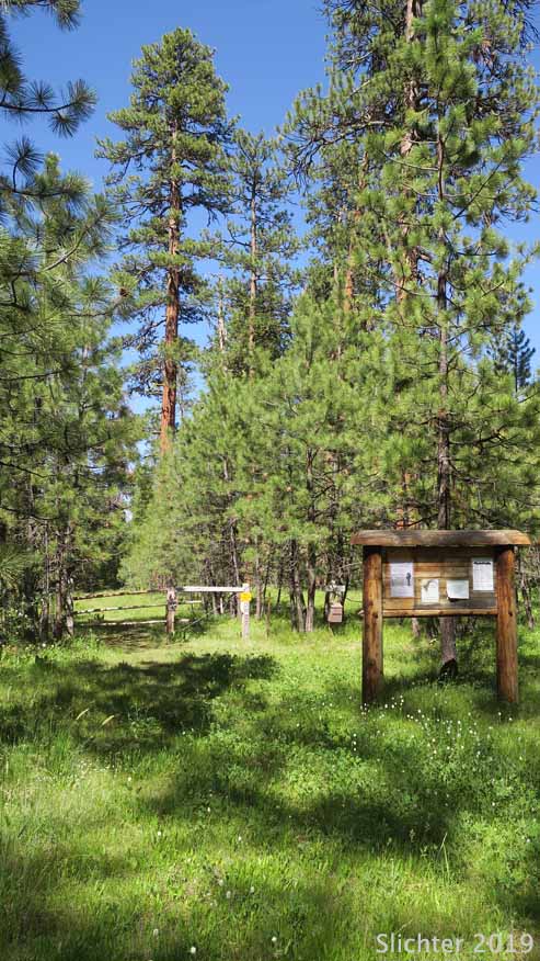
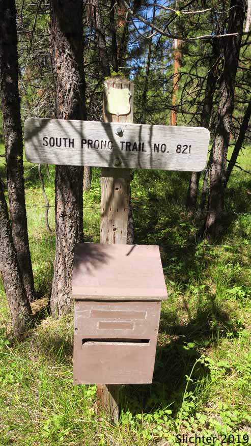
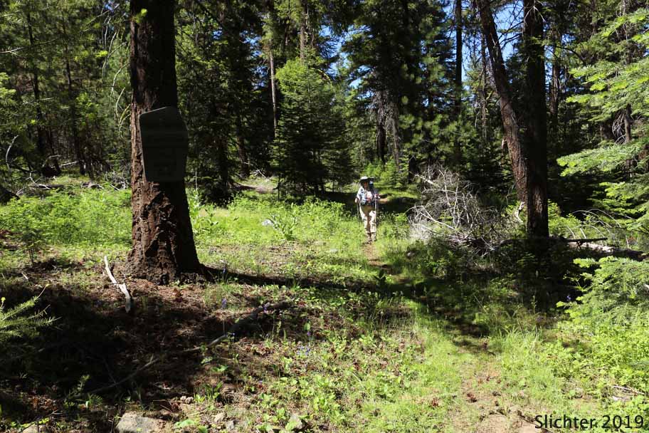
These 5 photos show the trailhead for the South Prong Trail #821 at Mud Springs Campground, Ochoco National Forest.....June 16, 2019. Evidently, registration is no longer needed for access to the wilderness as the box has been long out of use.
 -
-  -
- 
 -
- 
The photo at upper left shows the weathered boundary sign for the Black Canyon Wilderness found to the north and east of the South Prong Creek crossing along the South Prong Trail #821. The photo at upper center shows a view east down the South Prong Creek drainage from the South Prong Trail #821. Nice bunchgrass slopes with arrowleaf balsamroot and wavyleaf paintbrush can be seen along the trail here. The photo at upper right shows the South Prong Trail #821 as it passes through slopes of lupine and snowbrush as it approaches Crowbar Springs. All photos from this section taken in the Black Canyon Wilderness......June 16, 2019.
The photo at lower left shows that some sections of the South Prong Trail #821 get hard to find due to lack of use as one approaches Crowbar Springs. The photo at lower right shows buttercups and american bistort as found in moist areas along the South Prong Trail #821 on the south side of South Prong Creek (outside the wilderness, Ochoco National Forest......June 16, 2019.