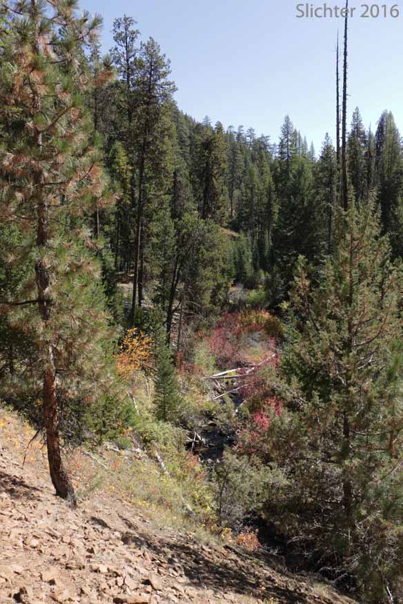
 The west end of the Ochoco Mountain Trail #823 is lightly used by hikers throughout the year. From the Rock Creek Trailhead on FS Road #38, the trail descends northward into the upper drainage of Rock Creek. After about a third of a mile or so, the trail crosses a sturdy bridge and then proceeds north along the east bank of Rock Creek. The trail stays out of the riparian area but closely follows the creek, then ascends the west-facing slopes and enters a mix of open forest and rocky balds that look down onto the creek. Eventually, the trail ascends uphill to the northeast towards the summit of Spanish Peak. For a more complete description of this hike, refer to William Sullivan's "100 Hikes/Travel Guide Eastern Oregon.
Since the area is at the east end of the forest, it doesn't get regular maintenance, so it doesn't hurt to call the Ochoco National Forest to enquire whether a trail crew has cleared the trail recently or not. In September 2016, there were numerous small trees over the trail, but it was not difficult to hike down the trail as far as Waterman's Ditch. Just upstream from Waterman's Ditch, the trail is narrow with a steep side slope, so this may be of concern for those who don't like height exposure.
Hike Description from Less Travelled Northwest
See Also: The hike description for Spanish Peak in "100 Hikes/Travel Guid: Eastern Oregon" by William L. Sullivan.
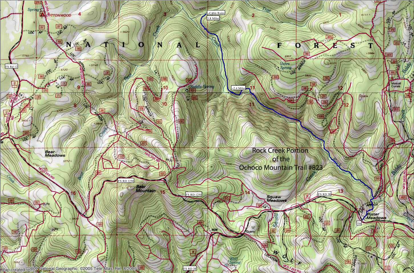
From Paulina: Drive east on the Paulina-Suplee Highway for about 3.5 miles and then turn left (north) onto Beaver Creek Road (County Road #113). Continue uphill for about 7.5 miles to where the road becomes FS Road #42 upon entering the Ochoco National Forest. Continue another 1.5 miles to a Y intersection near Wolf Creek Campground. Take the right for, FS Road #3810 and follow it for about 7 miles to a junction with FS Road #38. Turn right (east) on FS Road #38 and follow it eastwards for about 3.5 miles to a signed trailhead and small parking area on the north side of the road opposite signed Potter Meadows.
From Deep Creek Campground and Big Summit Prairie: Drive east on FS Road #42 which is paved until after crossing Deep Creek, then continue east on a good gravel road on FS Road 42 to a major interestion (Six Corners on the map). At this junction, stay straight on what is now FS Road #12. After several miles, FS Road #12 turns sharply left at a junction. Stay straight on what becomes FS Road 38. After another 1.5 miles, FS Road #38 reaches a junction with FS Road #3810 on the right (signed for Paulina). Stay on FS Road #38 and follow it eastwards for about 3.5 miles to a signed trailhead and small parking area on the north side of the road opposite signed Potter Meadows.
Do not leave valuables in the car, although this trailhead may be safer due to the distance from any towns or cities. The area will see a lot of weekend traffic on Road #38, so it is best to be safe!
Note - Approximate Driving Mileage and Times (one way) from Prineville:
Via OR 380 & Paulina - 78 miles and 2 hours 10 minutes.
via NF Road 42 & 38 - 66 miles and 2 hours 15 minutes
via US 26 and FS Rd 12 to FS Rd 38 - 81 miles and 2 hours 20 minutes
Plant Lists for Lookout Mountain:
July 13, 2017: Rock Creek via the Ochoco Mountain Trail #823 hiking north from the trailhead on Road 38. (Ochoco National Forest). We hiked about 1.5 miles downstream before turning back due to the high number of downed trees.
September 27, 2016: Rock Creek via the Ochoco Mountain Trail #823 hiking north from the trailhead on Road 38. (Ochoco National Forest)