From the parking area near the campground, cross FS Road 2017 and walk towards the observatory buildings. Proceed through the "quiet zone" gate and head for the small hill beyond the domes. Look for a narrow path that proceeds east up the hill past the observatory dome. The trail climbs 0.1 miles to the summit of the small hill. The path becomes fainter as it descends 0.25 miles as it descends to FS Road 2017. Walk east on the forest road for 0.6 miles to a point where the road turns sharply downhill to the south, look for a path to the left proceeds through a saddle and enters old growh ponderosa pine forest. After an additional half mile, the trail climbs to the summit of a peak with good views. Continue around its right side and descend to another saddle. From that saddle, climb about 0.3 miles to the true summit of Pine Mountain, again with more good views all around.
For a gentler beginning, hike the FS Road 2017 uphill from the campground for about a mile. Where the road turns sharply downhill to the south, look for a path to the left that continues east uphill along the ridgetop and proceed as above.
This unofficial trail is about 4 miles RT. Elevation gain is approximately 1000'. It should be noted that there are other opportunities to hike cross country west and north along the slopes of Pine Mt. from the summit area and to make stops along FS Road 2017 along the way up to the campground from US 20 once you are on Deschutes NF lands.
Facilities at Pine Mt. Campground: 6 single campsites with picnic tables, fire rings and vault toilet but no potable water. It's a primitive campground, but the campsites are fine with tall ponderosa pines providing shade. If you camp here, be sure to find a clearing to view the sunset and stars! During our July 2017 visit, there were a number of cattle inhabiting the campground.
From Bend, drive east on US Highway 20 for about 24 miles (from the SW corner of Pilot Butte Park). At the east end of the ghost town, Millican, turn right (south) onto gravelled Pine Mountain Road (well signed) which becomes FS Road 2017, climbing for about 8 miles to the Pine Mt. Campground. Park near the campground.
From downtown Prineville, drive west on US Highway 26. At the west end of Prineville, follow signs for Redmond/Bend and proceed southwest on Oregon Highway 126. After about 2.5 miles, turn left (south) onto SW Millican Road (opposite Airport Way and the Prineville Airport. Essentially, stay straight on the paved road between Oregon Highway 126 and US Highway 20. There are a number of OHV roads that intersect Millican Road, and several major gravel roads, but the route should be obvious. If in doubt, here's additional directions provided by Google: About 18 miles south of OR126, stay straight onto Road 6520. After another 5.5 miles, stay straight on George Millican Road. After another 3.4 miles you will arrive at US Highway 20. Turn right (west) onto US 20 and drive about 3.4 miles. At the east end of the ghost town, Millican, turn left onto gravelled Pine Mountain Road which becomes FS Road 2017, arriving at the Pine Mt. CG after about 8 miles. Pine Mt. is about 45 miles and slightly more than an hour south of Prineville. Park near the campground.
The road from US Highway 20 up to the observatory and campground parking areas appears to be kept in pretty good shape. It's gravel, but the road bed is wide and not too washboarded. Watch out for a few stray cattle on the road.
May 12, 2018: Wildflowers from the Pine Mountain Campground uphill to the rocky summit above the observatories.
July 11, 2017: Wildflowers from the Pine Mountain Campground south and east along the summit ridge to near the highest point of the Pine Mountain Summit.
 -
- 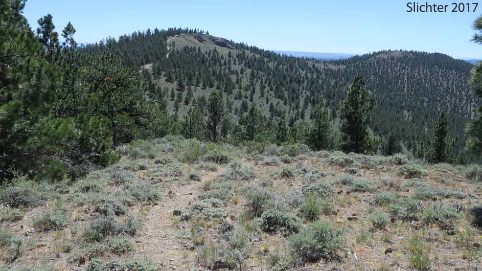
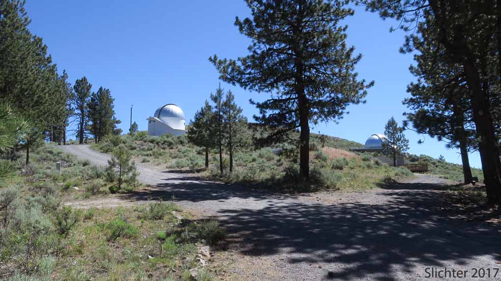
Photo at left: A view towards the observatories from the observatory parking lot. Photo at right: A view south from the hilltop directly south of the observatories. The path here becomes fainter but trends towards the road at the bottom of the hill. Pine Mountain, Deschutes National Forest.......July 11, 2017.
 -
- 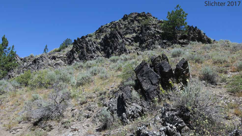
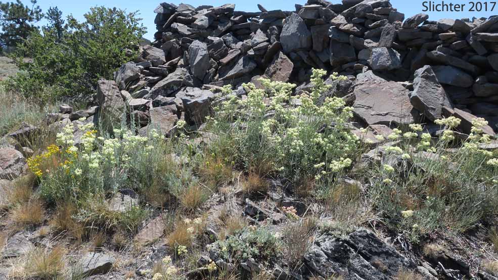
Photo at left: Some of the wildflowers from the summit of the hill above the observatories. Photo at right: Wildflowers galore on rocky slopes nearing the actual summit of Pine Mountain, Deschutes National Forest........July 11, 2017.
 -
- 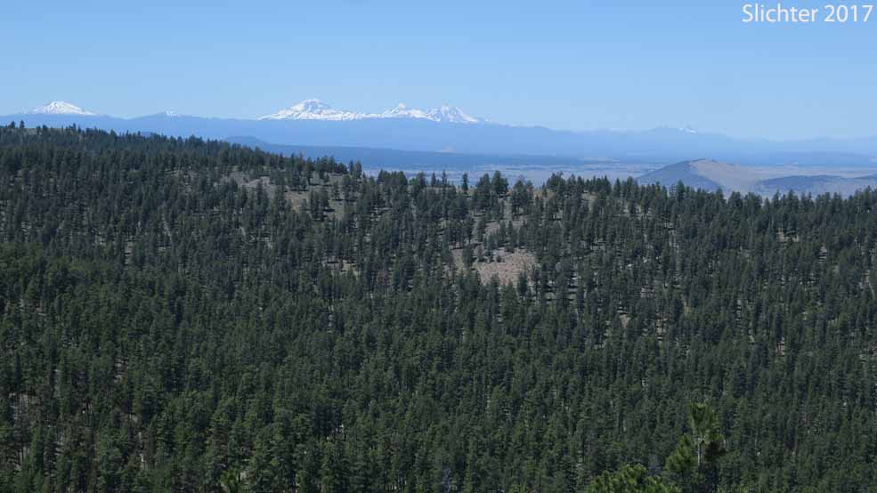
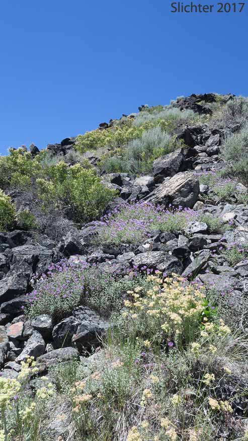
Photo at left: Wildflowers near the actual summit of Pine Mountain, including mountain balm, rock spiraea and parsnipflower buckwheat. Photo at right: A view northwest towards the Cascade volcanos from the summit ridge of Pine Mountain, Deschutes National Forest........July 11, 2017.
 -
- 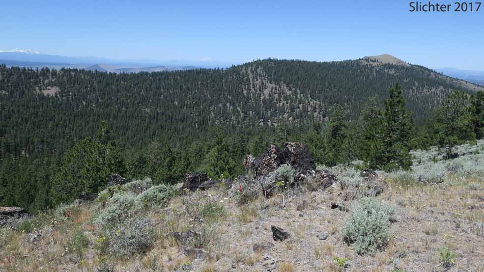
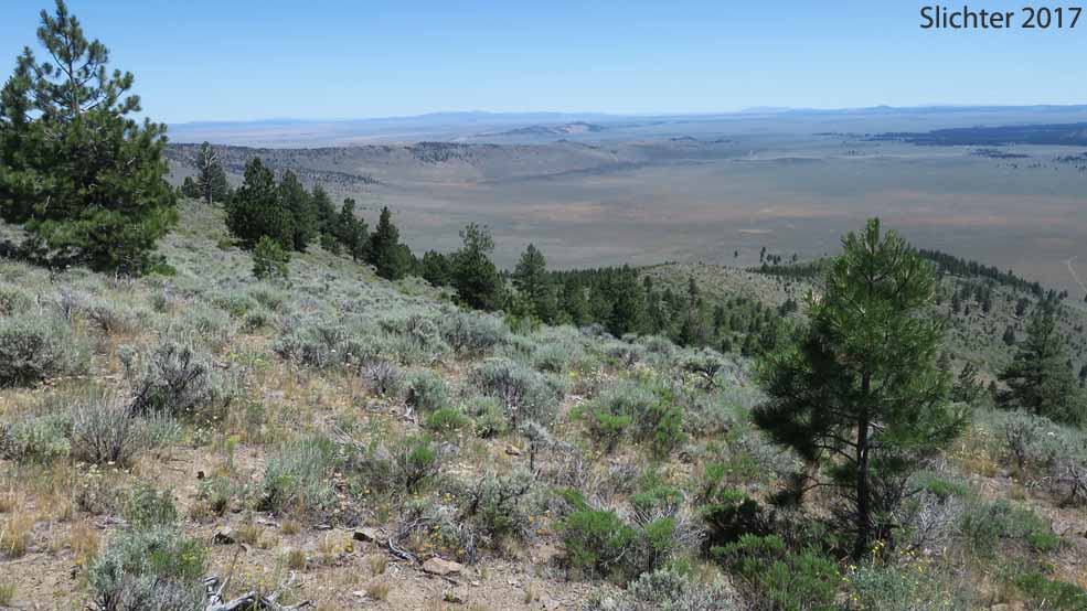
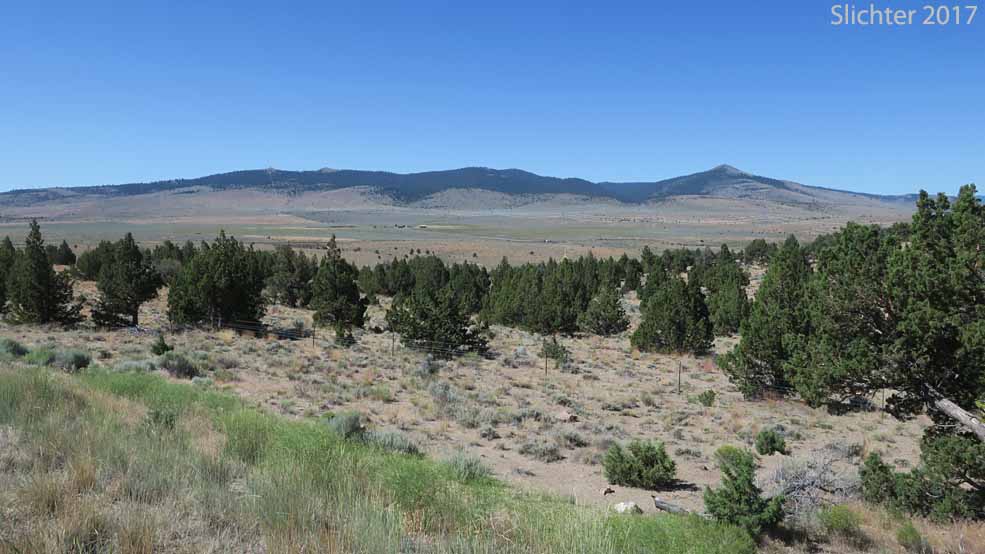
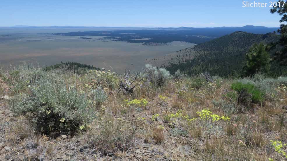
Photo at left: View south towards northern Lake County from the summit ridge of Pine Mountain. Photo at right: A view north to the northern ridge of Pine Mountain, Deschutes National Forest........July 11, 2017. The access road comes up the canyon below and climbs to the saddle at the center of the photo.