 -
- 
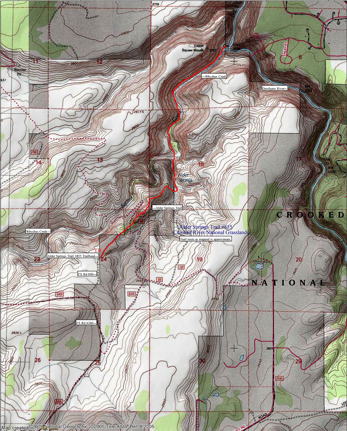 At right find a map of the approximate route of the Alder Springs Trail #855. For printing purposes onto standard paper size, the image would need to be reduced.
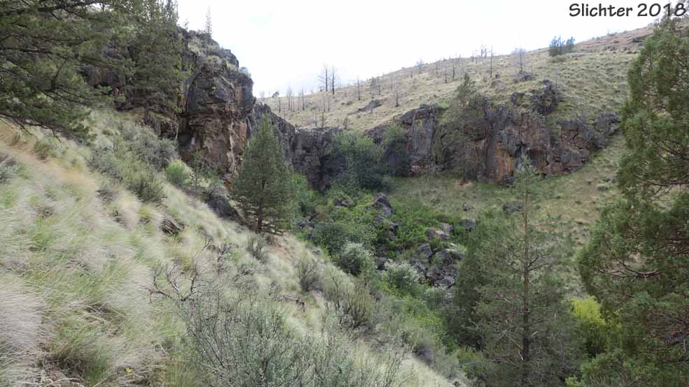
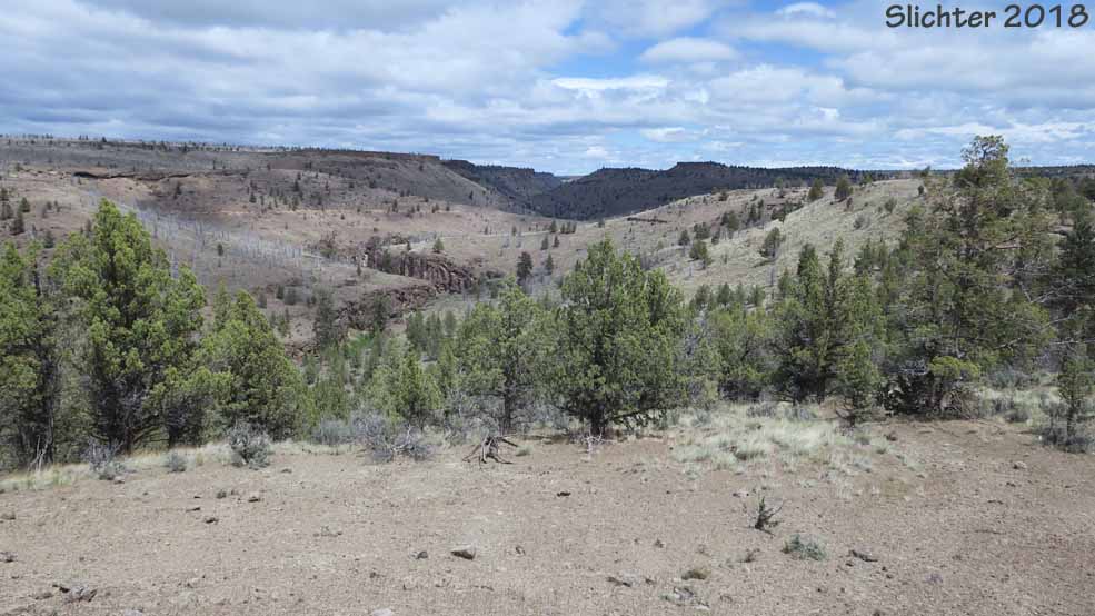
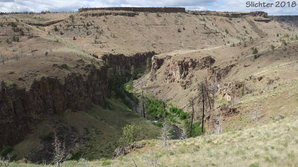
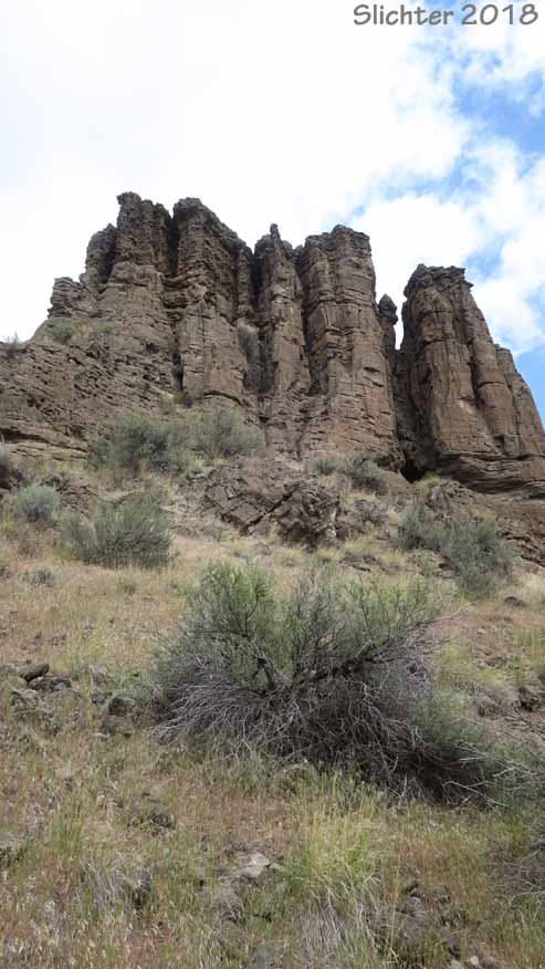
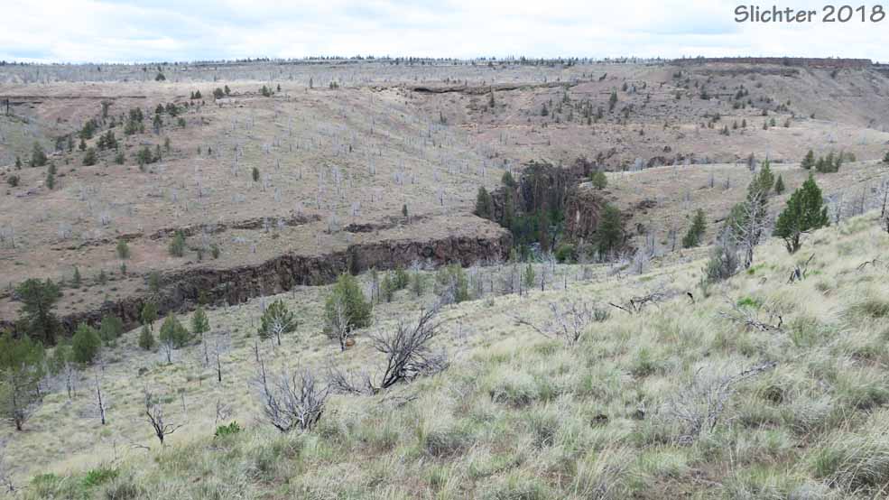
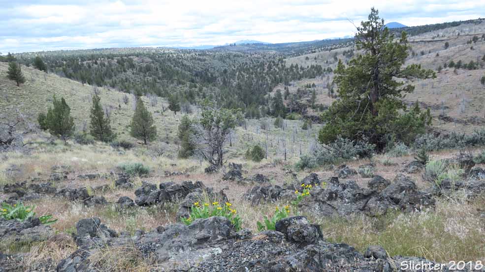
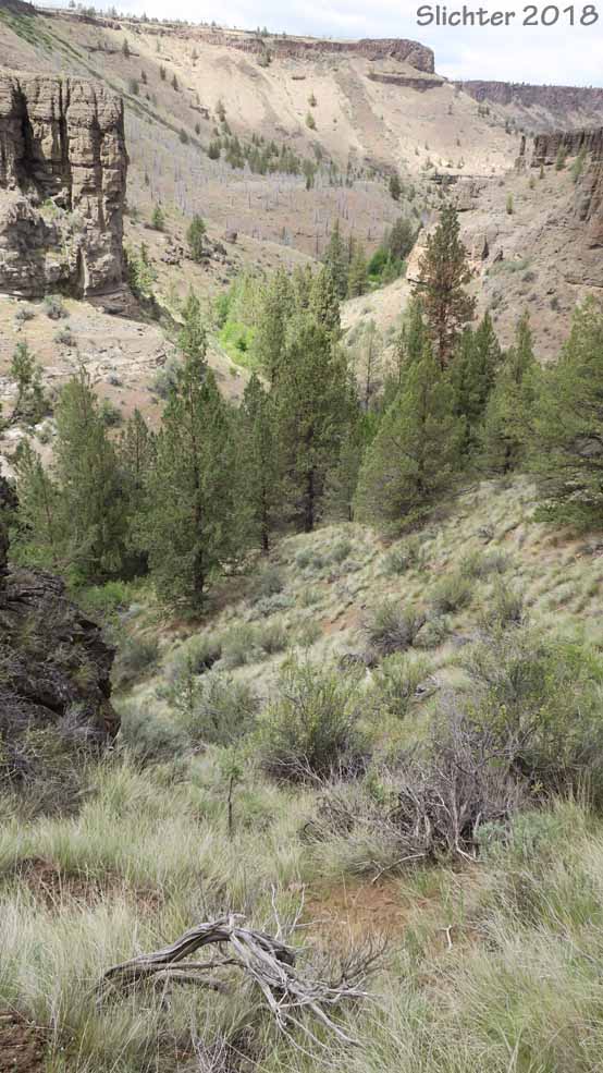
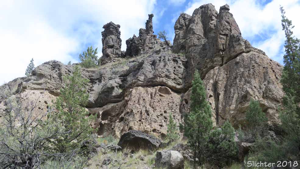
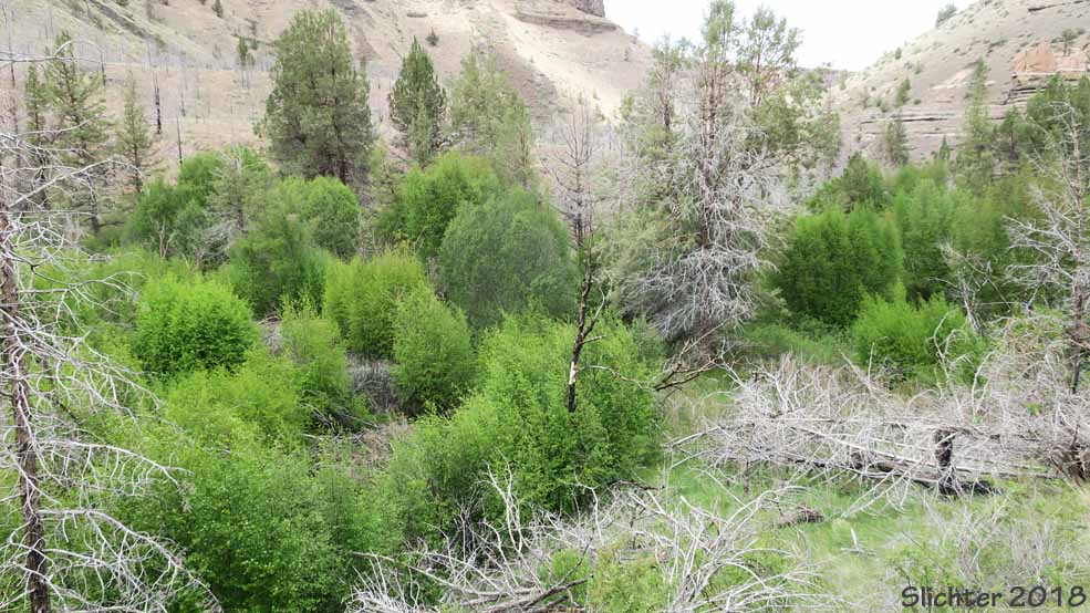
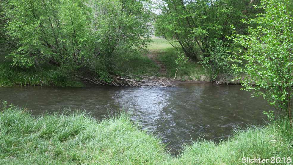
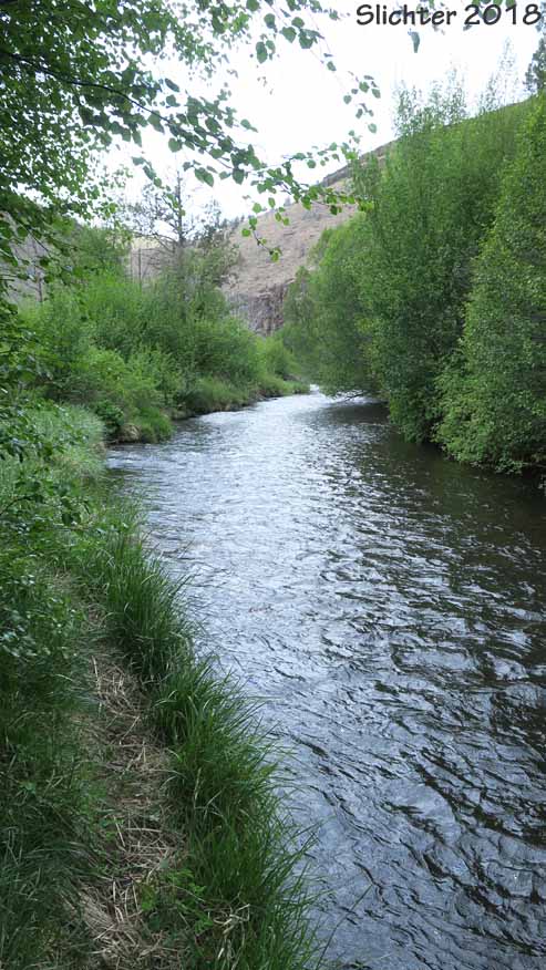
The canyons around Alder Springs and at the mouth of Squaw Creek are among the most impressive in the entire Deschutes River drainage. The multi-layered and varied-colored walls record over 7 million years of Central Oregon geological history. Ecologically, this area is in better condition than many of the agricultural lands surrounding it. The trail passes through some good bunchgrass slopes with several types of rabbitbrush and sagebrush with numerous spring wildflowers. The views down into Whychus Creek are stunning as the stream meanders through the deep, rocky canyon. The stream has good riparian vegetation (willows, mountain alder, western water birch and creek dogwood) and supports a native fishery. It's quite amazing to note the transition from dry native grasslands to bubbling stream riparian oasis as one descends past the head of Alder Springs.
The trail is well graded with a gentle slope on sandy substrate for much its course down to Whychus Creek, with one moderately difficult stairstep climb (4 large steps) onto a low butte about one-quarter mile from the trailhead and then a steep 200 meter section of trail uphill from Whychus Creek to the wash directly above Alder Springs. I'd recommend hiking poles for those who use them, but for the most part, the hike is pretty easy. The trail is moderate and only 3 miles long round trip with 300-400' elevation gain on the return if hiked only to Whychus Creek. The trail is 6 miles long with about 500' elevation gain on the return if hiked all the way downstream to the Deschutes River. One must ford 30' wide (15' wide in summer) Whychus Creek to continue hiking to the junction with the Deschutes River. High water from mid-winter to mid-spring can be difficult. The water usually calms down and the creek becomes shallower (mid-calf) as summer approaches. Plan on bringing light water shoes or hiking sandles if you plan to hike the full route. Depending on the time of year, as always in the High Desert, watch out for rattlesnakes!
In hot weather, do this hike early in the day, bring plenty of water and wear a shade hat and sun clothes as there is plenty of exposure to the sun. Most reviews of this hike that I've seen give it 4 or 5 stars out of 5. Just remember that the stream crossing and climb backout of the canyon can be a challenge for less capable people.
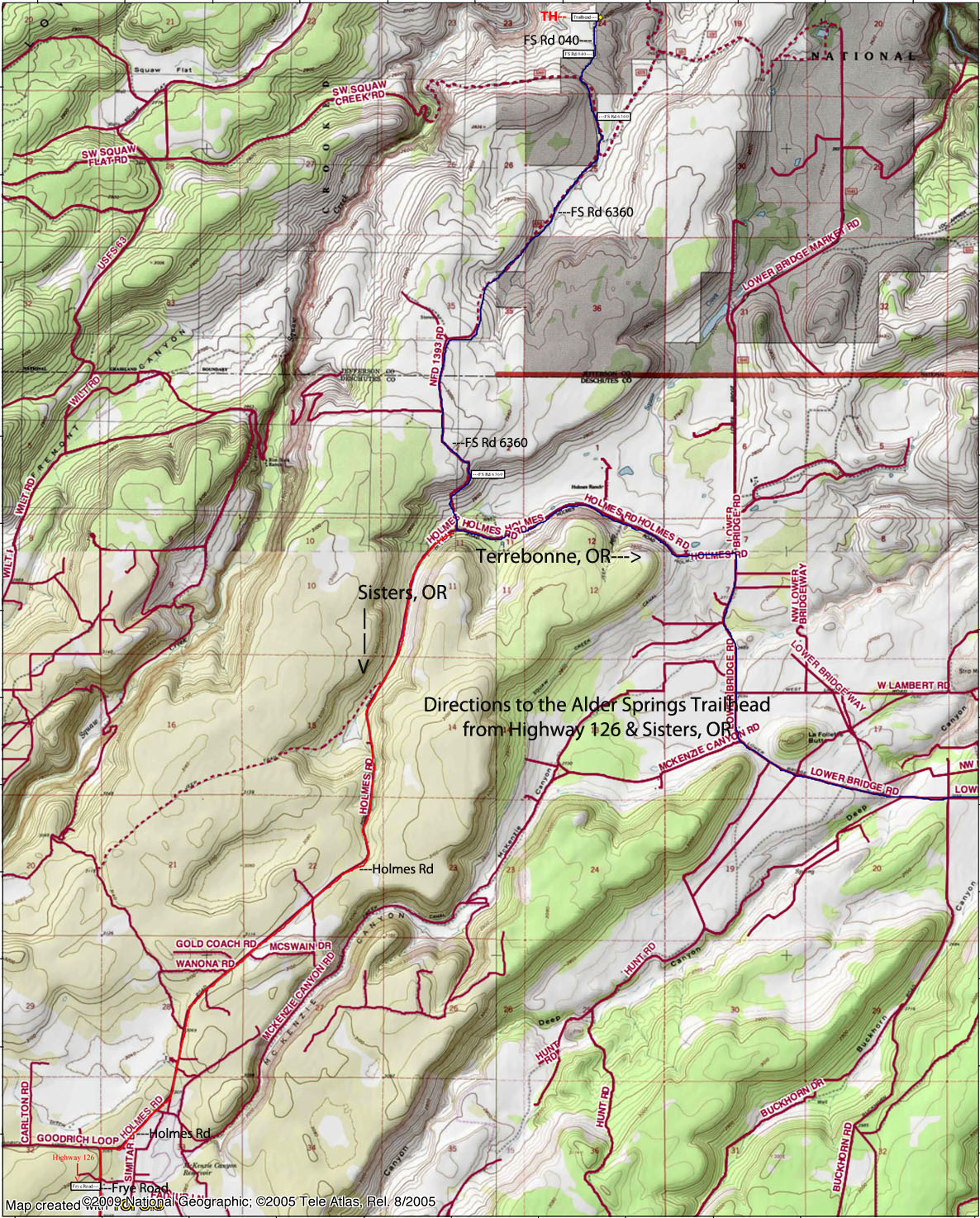
Note: The final several miles of road to access the trailhead are rough in spots (washboarding, some rocks and ruts from early season drivers). A high clearance vehicle (Subaru or similar, or shorter wheelbase vehicle) with good tires is recommended. Plan on taking it slow for the half hour drive of the road between paved Holmes Road and the trailhead.
Wildflowers
Expect to find: Indian ricegrass (Achnatherum hymenoides), sagebrush mariposa (Calochortus macrocarpus var. macrocarpus), desert paintbrush (Castilleja chromosa), red - osier dogwood (Cornus sericea), Deschutes monkeyflower (Diplacus deschutesensis or D. cusickioides), bottlebrush squirreltail (Elymus elymoides), Modoc sulfur buckwheat (Eriogonum umbellatum var. modocense), needle and thread grass (Hesperostipa comata), western blue flag (Iris missouriensis), apricot-colored blossoms of bitterroot (Lewisia rediviva), basin wild rye (Leymus cinereus), Lewis' blue flax (Linum lewisii var. lewisii), showy penstemon (Penstemon speciosus), Hood's phlox (Phlox hoodii), threadleaf phacelia (Phacelia linearis), mock-orange (Philadelphus lewisii), chokecherry (Prunus virginiana var. melanocarpa), and panicled deathcamas (Toxicoscordion paniculatum).
Plant Lists:
Comprehensive Plant List for the Alder Springs Trail #855 and adjacent uplands near the canyon rim.
May 11, 2018: Alder Springs Trail #855 (Crooked River National Grasslands)
Alder Springs Trail #855: A list of common plants found along the trail (courtesy of Stuart Garrett, MD, High Desert Chapter NPSO).
Additional Information Regarding the Alder Springs Trail #855:
Alder Springs Hike (from nwhiker.com) - Trail description and map with numerous photos from along the trail.
Alder Springs Hike (from cascaderamblings.com) - Several photos of the hike, including a pic of the broad but shallow creek crossing.
Alder Springs-Lower Whychus Creek Hike (oregonhikers.org) - Good trip description, photos,links to additional trip reports and additional resources.
Additional Alder Springs Info - graciously provided by Stu Garrett, MD (High Desert Chapter NPSO)
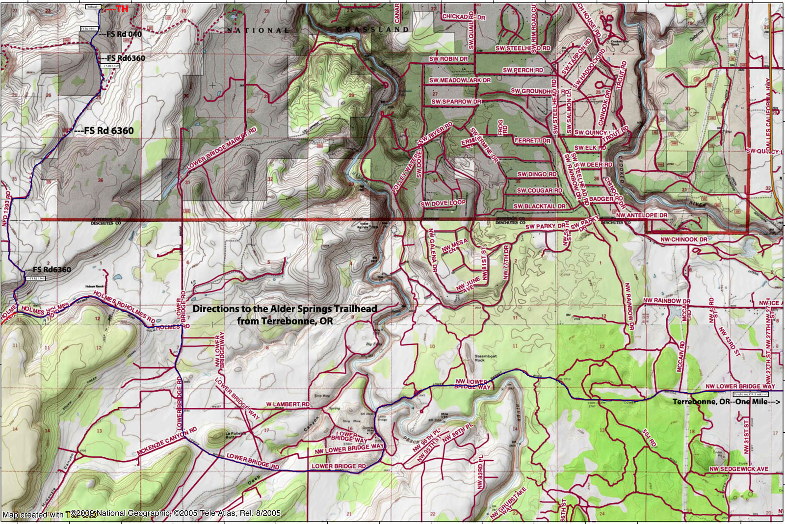
Directions to Alder Springs (from Ochoco NF webpage): https://www.fs.usda.gov/recarea/ochoco/recarea/?recid=38278)
From US Highway 97:
Just north of Terrebonne, Oregon exit west onto Lower Bridge Road and continue for approximately 12 miles, until it turns to gravel.
Turn left onto Holmes Road, which is paved.
(NOTE: Please watch for the turn off to Holmes Road. It is a common mistake to miss this turn from Lower Bridge Road onto Holmes Road but you will end up on private property with no driving route to the trailhead.). There should be a brown sign indicating the direction towards the Alder Springs trailhead at this junction.
Stay on Holmes Road for approximately 2 miles.
Turn right onto Forest Service Road 6360 (again with a brown sign indicating the Alder Springs trailhead).
Continue along this road for about 4.2 miles of bumpy dirt road travel. Be sure you have brought a high clearance vehicle (Subaru Outback or similar with good tires) as the road has several sections of washboard, some ruts and rocky sections. Expect to take about 30 minutes to drive the 5 miles of road from Holmes Road to the trailhead.
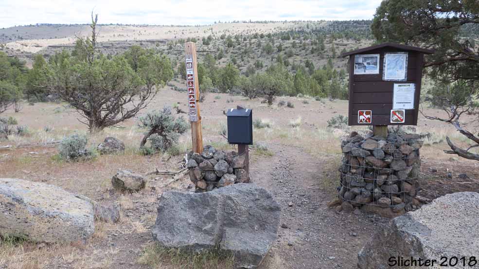
After 4.2 miles, turn right onto Forest Service Road 040 (again signed with a brown sign indicating the trailhead). Stay on this road for about 1 mile until you come to the Alder Springs Trailhead parking lot. There are no toilet facilities nor any water at this trailhead.
From Highway 20:
At milepost 8 between Sisters, Oregon and Bend, Oregon turn north onto Fry Rear Road and head toward OR Highway 126.
Cross the highway then stay straight to merge onto Holmes Road. Holmes Road makes a sharp right at the "T" intersection, so be sure to stay on Holmes Road and continue on to milepost 7.
At milepost 7 turn Left onto Forest Service Road 6360.
Continue along this road for five miles of bumpy dirt road. Be sure you have brought a high clearance vehicle (Subaru Outback or similar with good tires) as this section may be impassable for low clearance vehicles.
Turn right onto Forest Service Road 040 and continue about a mile until you reach the Alder Springs Trailhead parking lot.
General Notes:
There is a gate located on Forest Service Road 6360 that is closed and LOCKED from December 1st through March 31st every year to help protect winter range for the local deer populations. Hiking and biking are welcome beyond the gate during the closure, but please respect this motorized closure.
 -
- 
 -
- 
 -
- 
 -
- 
 -
-  -
-