 -
- 
 -
- 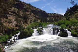
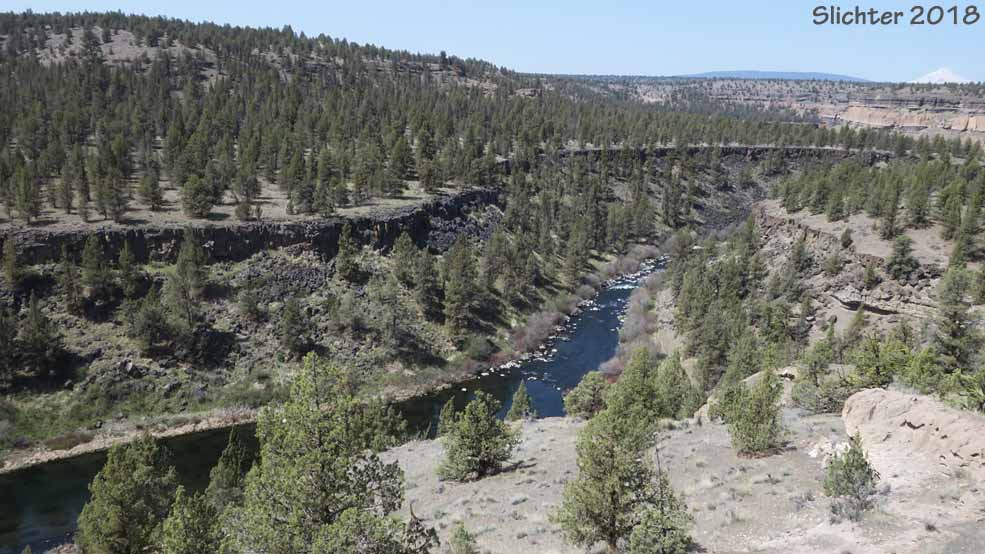
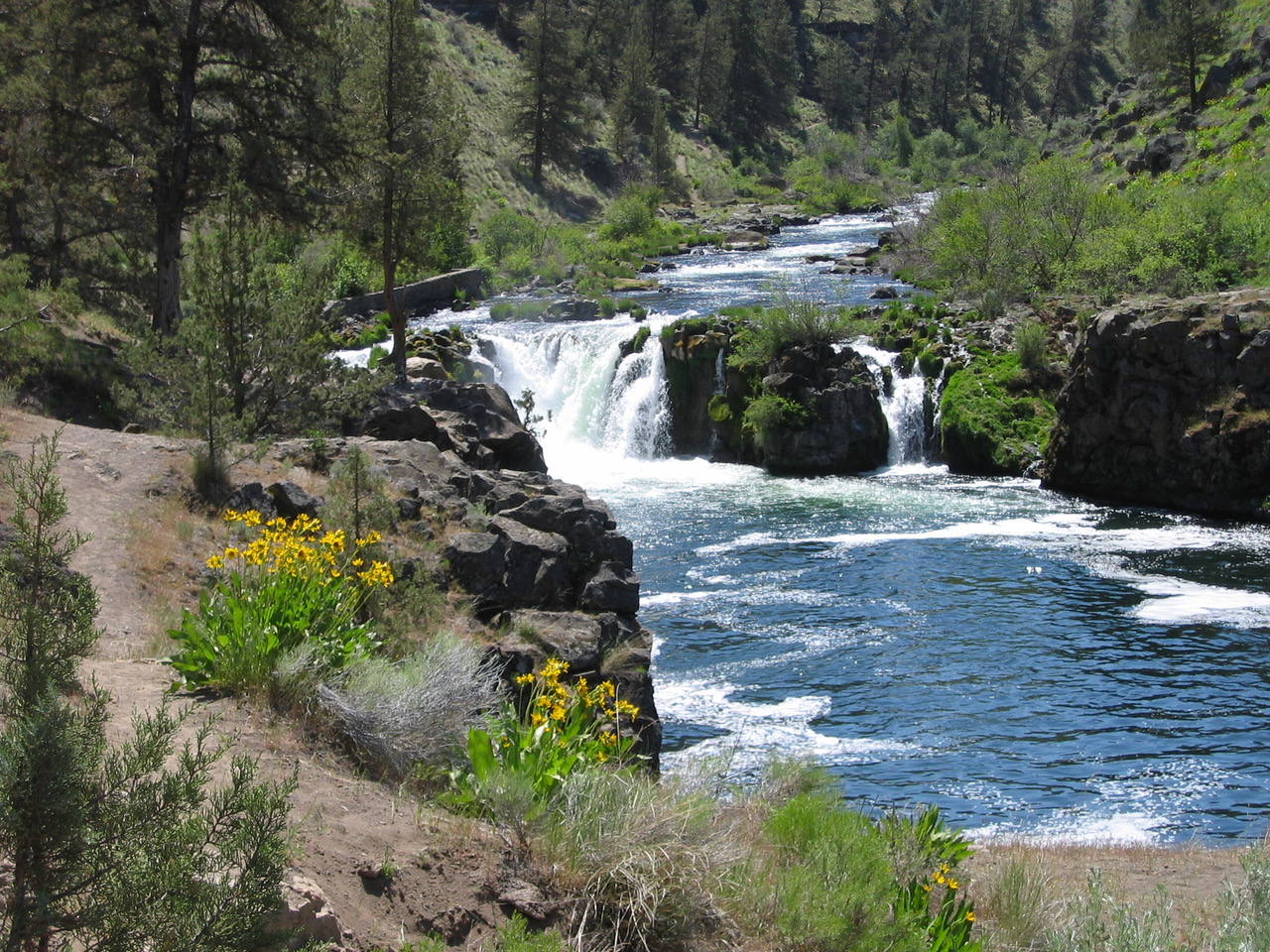
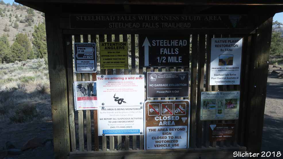
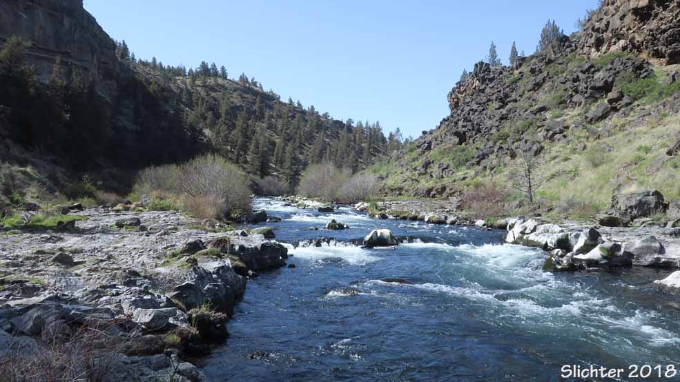
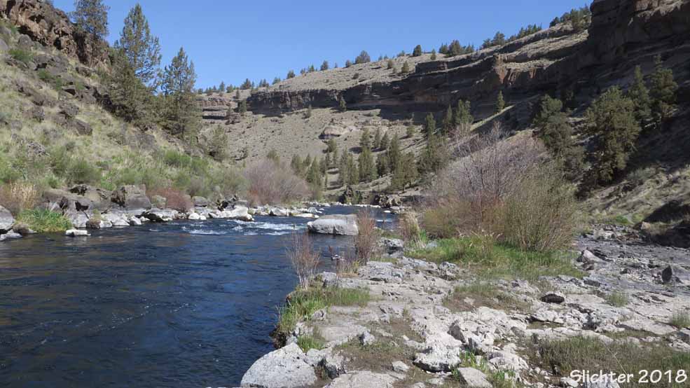
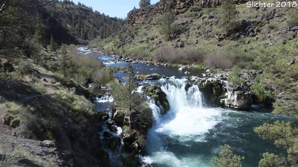
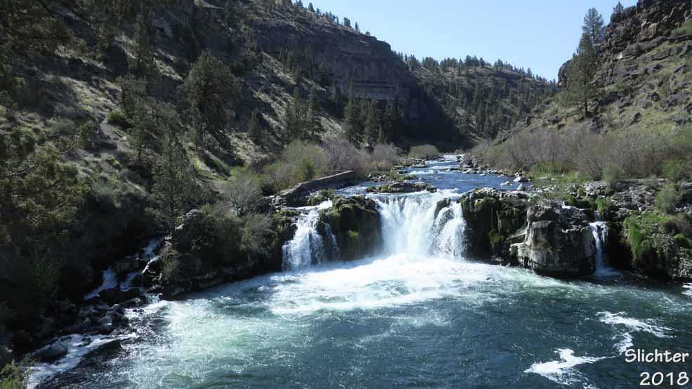
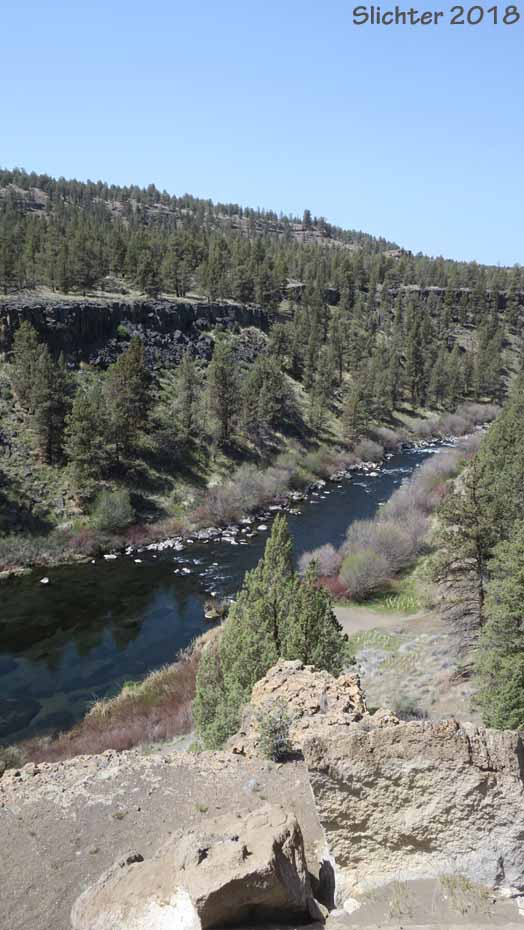
The Steelhead Falls Trail affords numerous scenic views into a gorgeous river canyon with numerous spring wildflowers. Steelhead Falls is named for the steelhead and salmon that used to leap up the falls before the river was dammed. The brick remains of an old fish ladder are still visible alongside the falls. The trail is in part of the Deschutes Canyon-Steelhead Falls Wilderness Study Area which helps preserve the area.
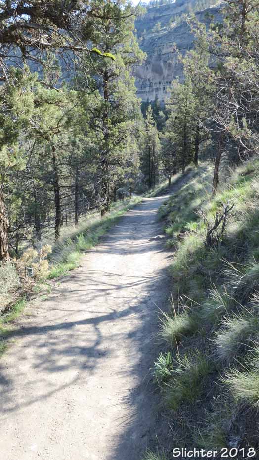
From the trailhead, the Steelhead Falls trail briefly follows the east rim of the Deschutes River canyon before dropping 130 feet in about half a mile. Downhill the trail faces north or downriver. The trail is fairly easy to hike although there are several steeper sections. The falls drop 20' but are surrounded by a semicircle of 30 basalt cliffs.
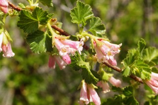
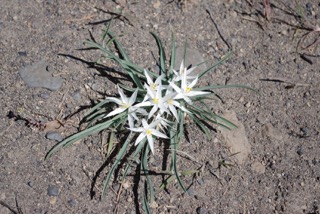
Wildflowers: Around Memorial Day, expect to find some of the following: threadstalk milkvetch (Astragalus filipes), Carey's balsamroot (Balsamorhiza careyana), arrowleaf balsamroot (Balsamorhiza sagittata), possibly an early sagebrush mariposa (Calochortus macrocarpus), desert paintbrush (Castilleja chromosa), western prairie clover (Dalea ornata), threadleaf fleabane (Erigeron filifolius), yellow desert daisy (Erigeron linearis), rock buckwheat (Eriogonum sphaerocephalum), sulfurflower buckwheat (Eriogonum umbellatum), bush oceanspray (Holodiscus microphyllus), bitterroot (Lewisia rediviva), granite prickly phlox (Linanthus pungens), blazing star (Mentzelia laevicaulis), hotrock penstemon (Penstemon deustus), lowly penstemon (Penstemon humilus), cutleaf penstemon (Penstemon richardsonii), showy penstemon (Penstemon speciosus), mock orange (Philadelphus lewisii), purple sage (Salvia dorrii), gray horsebrush (Tetradymia canescens) and showy townsendia (Townsendia florifer)
 Access:
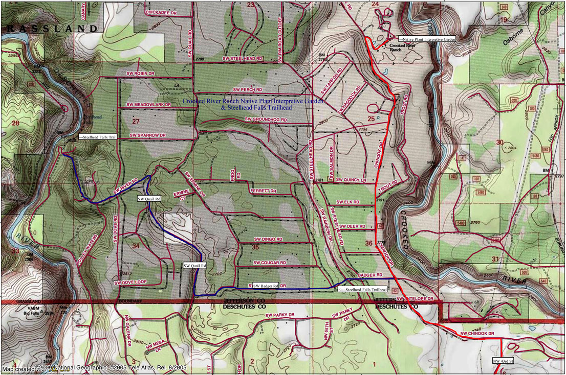
From Highway 97 in northern Terrebone, OR, turn west onto NW Lower Bridge Way (signed for Crooked River Ranch). After about 2.2 miles, turn right (north) onto NW 43rd St. and follow signs to the Crooked River Ranch. After about 1.8 miles, arrive at a "T" junction with Chinook Drive. Turn left (west) onto Chinook Drive (NW Chinook Way soon trends northwest) and proceed about 1.1 mile and turn left (west) onto Badger Road. Drive west on Badger Road to its end (about 1.8 miles) and turn right onto Quail Rd. Follow Quail Rd for about 1.2 miles to River Road where you will turn left. Follow River Road downhill about 1 mile to the signed Steelhead Falls Trailhead. The Steelhead Falls Campground (BLM) is just south of the trailhead parking area.
From Prineville: From the OR 126/US 26 junction in west Prineville, OR, drive west on OR 126 (as if heading towards Redmond and Bend). In about one quarter mile, after crossing the Crooked River, take the first right onto OR Highway 370W (Oneil Highway). After about 12.6 miles, turn right (north) at a junction with Lone Pine Road. Drive about 1.3 miles north on Lone Pine Road to a "T" junction with NW Smith Rock Way, turning left.. Drive west on NW Smith Rock Way about 4.8 miles, arriving at US Highway 97 in southern Terrebonne, OR. Turn right (north) onto US 97. At the north end of Terrebonne, turn left (west) onto Lower Bridge Way (Lower Bridge Market Rd on Google). Proceed as above. The Steelhead Falls Trailhead is about 45 miles (one hour) west of Prineville.
Plant Lists:
* Comprehensive Plant List for the Steelhead Falls Trail
April 25, 2018: Steelhead Falls Trail
April 23, 2017: Steelhead Falls Trail (courtesy of Friends and Neighbors of the Deschutes Canyon Area)
 -
-
 -
-
 -
-
 -
- -
-