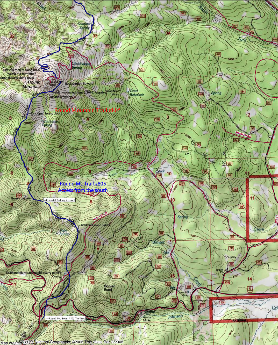
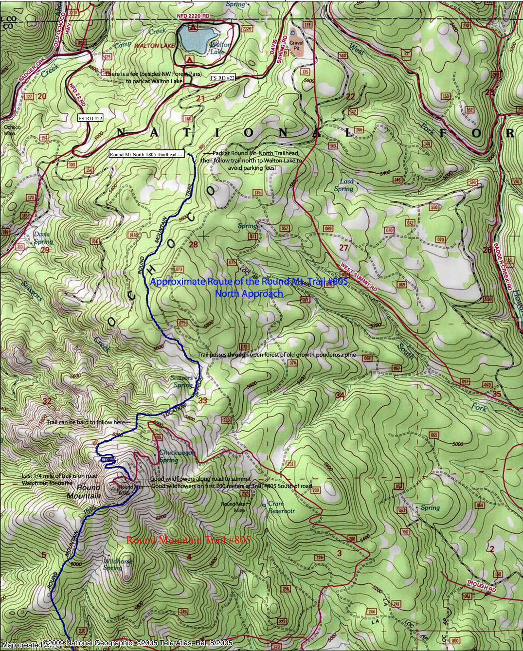
Maps of the approximate routes for the Round Mountain Trail #805 at right. (North Approach, left. South Approach, right.)
The Round Mountain Trail #805 is lightly used by hikers throughout the year although there is driving access to the summit of Round Mountain (high clearance vehicles or OHVs preferred), and vehicular traffic to the summit can be heavy on nice summer, weekend days. The trail from both trailheads is quite nice with the trails passing through a mix of forest, meadows and balds enroute to the summit. As far as I can tell, mountain bike use is light. Early in the season, there may be trees across the trail (not bad in late May 2016), so call the Ochoco National Forest Headquarters to determine trail conditions in advance. Sheep graze the meadows in August.
The last quarter mile of the hike follows the access road to the summit. Nice wildfflower displays can be observed along the road cuts here, and more can be seen around the summit buildings. Try not to sit on the wildflowers so they can persist here and so other future hikers and enjoy them! There is also a nice rock garden display for the first 200 meters of the south approach trail below the summit road, and the switchbacks for the north approach trail below the summit is worth exploring too if there is time.
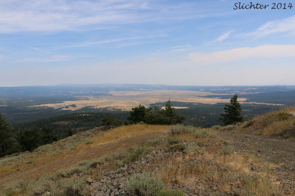
From the summit one has views westward to the High Cascades. Nearby to the north is Mt. Pisgah and to the northeast is Spanish Peak. Lookout Mountain dominates the skyline several miles to the southeast while Big Summit Prairie dominates the view several miles to the east.
Additional map of Lookout and Round Mountain Trails
From the north: From Prineville, Oregon, drive east on US Highway 26 for approximately 13 miles. Turn right onto County Road #123 (signed Ochoco Ranger Station and Walton Lake) and drive approximately 7 miles, passing the old Ochoco Ranger Station and then turning left onto paved Forest Service Road #22 at a Y junction just past the old ranger station. Paved Road #42 heads uphill to the right at this junction to the south trailhead. Continue uphill on FS Road #22 for approximately 7 miles. Just after passing the entrance to Walton Lake Campground, take the first right onto a gravel road which deadends at a large gravel lot for the Round Mountain North trailhead.
From the south: Proceed as above from Prineville, but just past the old Ochoco Ranger Station, take the right fork which is paved FS Road #42. Drive uphill approximately 7 miles to a pass. At the pass, turn right onto a gravel road (FS Road #4205) and after about 30 yards, the large gravel parking lot for the Round Mountain South trailhead will be at your left.
The north trailhead is about a 51 mile (50-60 minute) drive one-way from Prineville. The south trailhead is about a 31 mile (45 minute) drive one-way from Prineville.
Northwest Forest Passes are not required at either trailhead. There are no restroom facilities, picnic tables, nor water at either trailhead. Carry sufficient water for a full day's hike here as there are few (if any) places to filter water along either approach.
Plants to usually expect along the Round Mt. South Trail from Memorial Day weekend into early June include: heartleaf arnica (Arnica cordifolia), creeping Oregon grape (Berberis repens), rough eyelashweed (Blepharipappus scaber), upland larkspur (Delphinium nuttallianum), dark-throat shooting star (Dodecatheon pulchellum), mission bells (Fritillaria atropurpurea), yellow bells (Fritillaria pudica), dwarf hesperochiron (Hesperochiron pumilus), ballhead waterleaf (Hydrophyllum capitatum var. alpinum), Nevada lewisia (Lewisia nevadensis), slender woodland star (Lithophragma tenellum), puccoon (Lithospermum ruderale), Donnell's lomatium (Lomatium donnellii), long-flowered bluebells (Mertensia longiflora), alpine pennycress (Noccaea fendleri ssp. glauca), daggerpods (Phoenicaulis cheiranthoides), western groundsel (Senecio integerrimus), and panicled deathcamas (Toxicoscordion paniculatum).
If you make it to the summit of Round Mt, expect: roundleaf alumroot (Heuchera cylindrica), leafy bluebells (Mertensia oblongifolia), Brown's peony (Paeonia brownii), shrubby penstemon (Penstemon fruticosus), sagebrush buttercup (Ranunculus glaberrimus), bighead clover (Trifolium macrocephalum), and downy-fruited valerian (Valeriana acutiloba).
Plant Lists for Lookout Mountain:
May 28, 2016: Round Mountain South Trail #805 (Ochoco National Forest)
August 9, 2014: Round Mountain North Trail #805 as done from the north from near Walton Lake Camp Ground (Ochoco National Forest)